CanWIN uses the Geonode open source geospatial content management system,. Geonode allows users to create their own maps using layers CanWIN has made available in the platform. Livestreamed data such as weather stations can also be viewed via pre-created dashboards. Data available in Geonode is accessible via the main CanWIN datahub to allow users to search for data using the federated (main) search page.
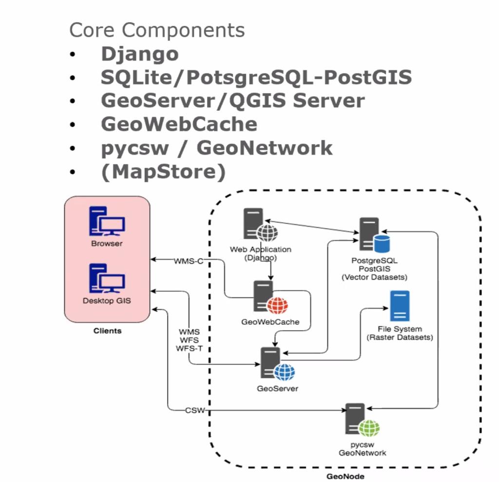
Data management tools built into GeoNode allow for integrated creation of data, metadata, and map visualization. Each dataset in the system can be shared publicly or restricted to allow access to only specific users. The diagram below outlines the general setup for geonode.
GeoNode allows users to upload vector data (currently shapefiles, json, csv, kml and kmz) and raster data in their original projections using a web form.
Vector data is converted into geospatial tables in Geoserver (in a PostGIS database). Satellite imagery and other kinds of raster data are retained as GeoTIFFs.
As soon as the upload is finished, the user can fill in the resource metadata in order to make it available through the CSW (OGC Catalogue Service) endpoints and APIs.
Users may also upload a metadata XML document (in ISO, FGDC, or Dublin Core format) to fill in key metadata elements automatically.