Cambridge Creek Hydrology
Data and Resources
-
Water Level (2021-08-19 to 2025-03-10)...
CSV
Relative water level data in metres (not surveyed to absolute...
-
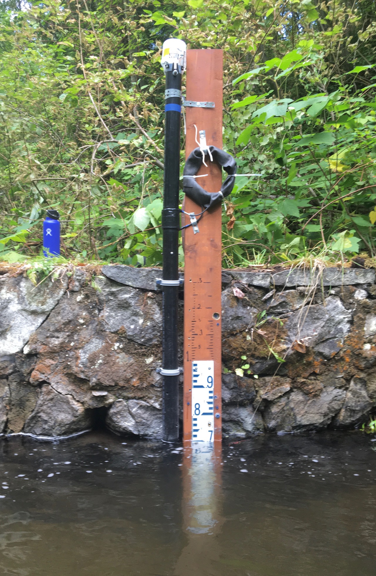
Photo (2021) Cambridge Creek (02) Gauge
JPEG
Photo of staff gauge and monitoring station on Cambridge Creek.
Additional Info
| Field | Value |
|---|---|
| Dataset Collection Organization | Bill Coedy/Rossland Streamkeepers |
| Dataset Steward Email | cbwaterhub@livinglakescanada.ca |
| Dataset Citation | Rossland Streamkeepers. (2021). Cambridge Creek (02) [Data set]. Columbia Basin Water Hub. https://doi.org/10.48511/CGY5-QN70 |
| Dataset Upload Year | 2021 |
| Dataset Earliest Record Start Date | 2021-08-19 |
| Dataset Latest Record End Date | 2025-03-10 |
| Dataset Funding Description | The MX2001 water level logger and staff gauge and the install costs were funded by the City of Trail. |
| Dataset Data Disclaimer | Data has not been certified by a hydrologist. No warranty or guarantee exists that the information is accurate, complete, current, or suitable for any purpose. The individual user must confirm the accuracy of the data and whether it will be appropriate for their purpose. |
| Other Data Sources | none |
| Brief description of dataset location | A water level logger in a pipe still-well and a staff gauge were fastened to a concrete rock wall above a weir structure that was installed in the 1930s by the City of Trail. The weir creates a deep quiet pond ideal for water level measurements. A turbulent Cambridge Creek flows into this area. The station is about 500 m upstream from the confluence with Trail Creek. |
| Dataset Type | Stream |
| Dataset Keywords | Water Level,Water temperature,Hydrometric,Stream,Community Research Grade,People and Perspectives |
| Dataset Latitude | 49.0827 |
| Dataset Longitude | -117.7553 |
| Dataset DOI | https://doi.org/ |
| Station URL |